Tutti i paesi / Regno Unito / England / View over the former Defford Airfield
View over the former Defford Airfield
Scuola · Regno Unito
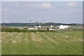
Viewed from Croome Park, the former WWII Defford Airfield is now the site of a satellite station. In the years since this picture was taken in 2005 the large satellite golf balls have been removed. To the left Until large telescope is part of MERLIN (Multi-Element Radio Linked Interferometer Net
- Tipo
- Scuola
- Paese
- Regno Unito
- Vicino a
- Worcester
La posizione esatta, le indicazioni stradali, le condizioni meteorologiche e i luoghi nei dintorni sono riportati sulla mappa.
Altri luoghi nelle vicinanze
- Ruddle Road Halt railway stationStazione ferroviaria
- Chedworth Halt railway stationStazione ferroviaria
- Speech House Road railway stationStazione ferroviaria
- Newnham railway stationStazione ferroviaria
- Ruspidge Halt railway stationStazione ferroviaria
- Bilson Halt railway stationStazione ferroviaria
- Drybrook Road railway stationStazione ferroviaria
- Westbury-on-Severn Halt railway stationStazione ferroviaria